Once I bought the game, I set about creating the map. I wanted to maximize the area of the covered as much as possible so I chose several of the more detailed maps and quilted them together in Photoshop. I used different colors for each map to sort of align them better.

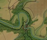
The result was a fairly large chunk of land, about 338 square kilometers, stretching from Allied jump-off point to just south of the St. Lo - Lessay road, and reaching from the Taute River to just east of the Vire. The map includes St. Lo in the bottom right hand corner. There is a ample road network, as well as river crossings and some varied elevation. Again, the main feature is the bocage.
Additionally, the battle narrative for this region provides ample excitement, with allied advances and SS counter-attacks. The actual duration of the battle was 12 days in the middle of July 1944. But more on the battle and the forces later.
After layering together the maps show above in Photoshop, I saved the file as a .bmp so it could be imported into the Map Maker tool. Then, I calculated the size of the area as best I could and created a new map file in the Map Maker to accomodate the size of my map. I then imported the .bmp by following the instructions in the game manual and I was ready to start creating the elevation layers, roads, towns, waterways, etc.
No comments:
Post a Comment